13 secret places in the Dnipropetrovsk region
In my previous articles I told about places in Dnipropetrovsk region, which can be visited during a day trip. Now I want to continue the story about these locations, but only this time they will be places that few people know about. You can find them on the map, but only if you look long and hard.
Abandoned camp Orlenok in Novotroitskoye
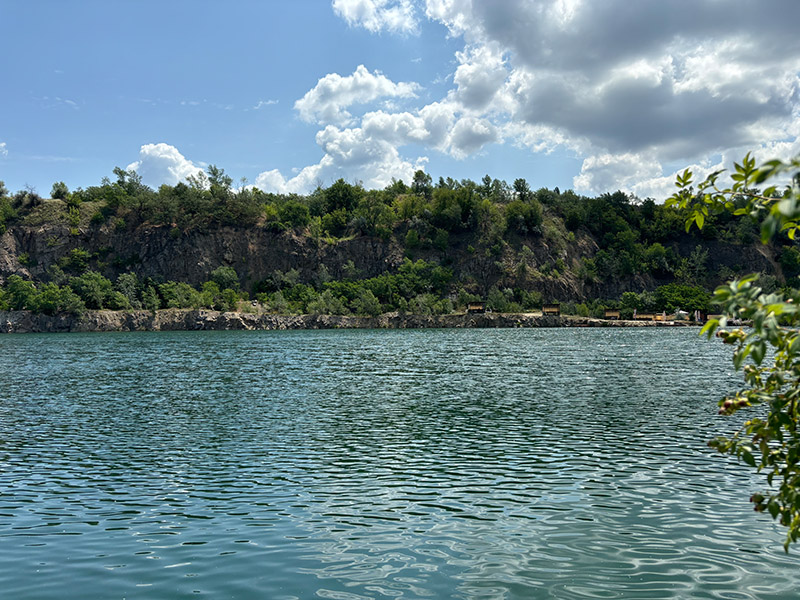
Once the village was called Znamenka, and in the 1960s and 70s a large pioneer camp called Orlenok was built on the edge of the forest near the Salty Liman Lake. It was intended for children of Yuzhmash workers and was a real pride among the pioneer camps of the region and the country.
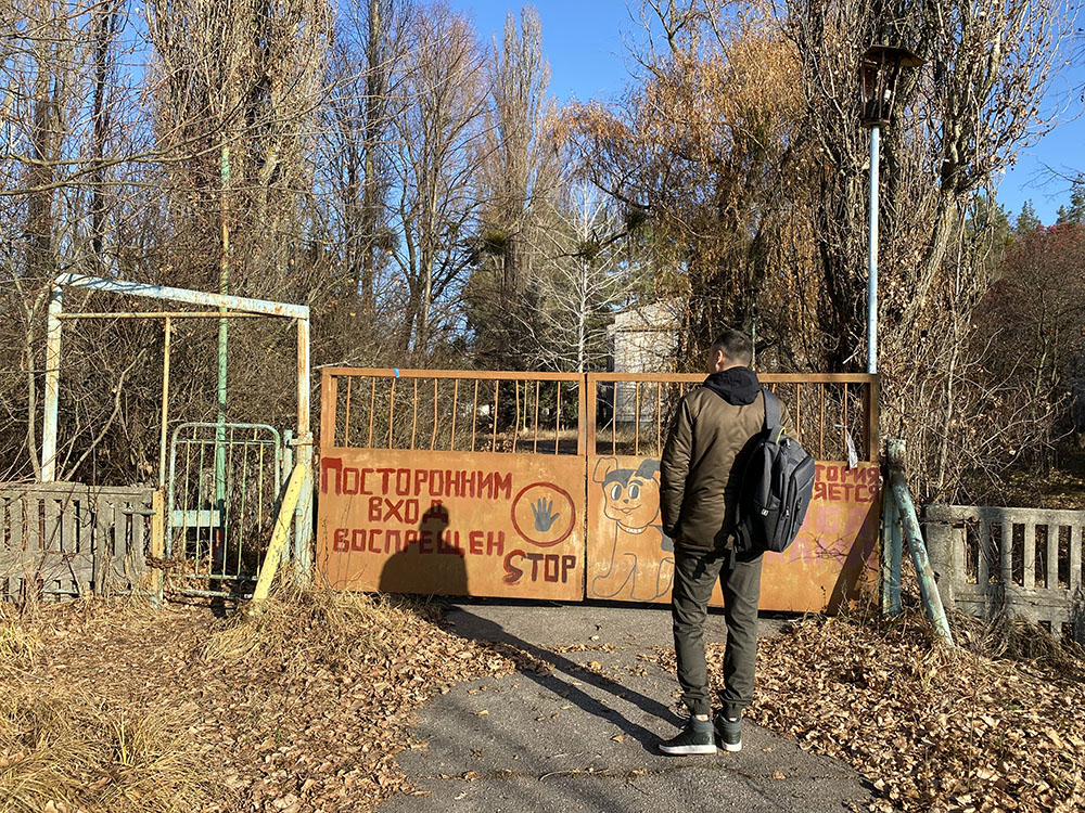
A huge infrastructure, which included its own theater, stadium, swimming pool, hospital complex, there was even a radio room. Now it all stands abandoned and overgrown, abandoned by garbage.
Orlyonok was closed in the early 2000s and now it’s just a place for strikeball competitions.
You can get to Orlenok both by bus from Dnipro and by your car.
Where is the abandoned camp Orlenok
Novotroitskoye, Dnepropetrovsk region.
The place of death of Prince Svyatoslav Igorevich of Kyiv
The Kyiv prince Svyatoslav Igorevich died in 972 during an unequal battle with the Pechenegs. He became famous for his successful campaigns and the expansion of his state.
Presumably prince was killed on a place of modern settlement Nikolskoe-on-Dnipro in the Dnepropetrovsk area, in 40 kilometers from Dnipro and Zaporozhye. This is one of the two supposed places of the tragedy. The second is on the island of Khortitsa. Both locations have a beautiful view of the Dnieper River.
In Nikolskoe-on-Dnipro there is a memorial sign in the territory of the former pioneer camp. From the highway Dnieper-Zaporozhye to the location shows a huge sign, but when you find yourself in the village, you still need to get on the territory of the camp. That is still a quest:).
The sign itself is cast iron and previously stood in another place, which was flooded with water. If you manage to get into the camp – you can not only admire the views, but also look at the frozen time here.
There are also a couple of other interesting places in the village – link to article. And there are still beautiful locations in the neighboring Troop, so it makes sense to capture two villages at once during the trip.
You can get to the place of Svyatoslav’s death by this address – Nikolskoe-on-Dnipro, Dnipropetrovsk region.
Abandoned Mennonite Mill in Mikhailovka
On the very border of the Dnepropetrovsk and Zaporozhye regions there is a village called Mikhailovka. And not far from the village is an inconspicuous place. I searched for a long time on the map and finally found it. It is the former Mennonite mill, in place of which is now a small waterfall, lake and bridge. Nearby is St. Michael’s Falls. Once there was a quarry and mined stone, and now flows a little stream among the boulders, which the locals and call a waterfall.
Mennonites were German immigrants, who started to settle large territories of Ukraine back in XVIII century. These people were engaged in farming and developing industry. On the territory of Dnepropetrovsk region there was their own community, which built the mill. Today it has not survived. There is even a museum nearby in Ruchaevka, where you can see the life of settlers.
Now only a stone bridge and a waterfall, which can dry up in summer, remind you of it.
You should come here at dawn in the morning or at sunset in the evening. The clean air and pleasant views are just right for a Sunday rest.
The Mennonite mill can be accessed at this address – Mikhailovka.
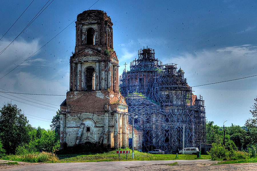
Ruins of the Red Bridge
Once upon a time, many years ago, a meteorite fell on this area, after which a picturesque gully was formed here. That was 400 million years ago.
When the land began to be actively developed – quarries and mines grew around, in which iron ore was extracted. Not surprisingly, red Paleozoic rocks come to the surface here. Soon, to carry the ore from the mines in the late 19th century, two railroad bridges were built. The spans stood on red brick stone piers. Some of the bricks still bear the marks of their builders. Approximately the bridge was built in 1898.
Now the ruins of the red bridge are in the landscape reserve. There are many species of rare plants, there are ancient fossils and great sunsets. And on the gully and the remains of the bridge – arrange competitions rock climbers.
A good place to come for a couple of hours on a warm summer day!
Address – Red Breadge in Kryvyi Rih.
Babina Tomb Monument
Right in the middle of the field near the village of Shevchenkivske there is a large memorial and monument to fallen soldiers in World War II. There is an asphalt road leading here. It is not in the best condition and then there is a concrete driveway.
The monument itself is a mound with a cannon at its highest point and a model of a dock.
It is strange that the monument is in such a remote place. Perhaps it is necessary and there were battles here.
The monument is located here – Dnipropetrovsk region.
Kryvorozhskaya Superdeep Borehole (SG-8)
You must have heard about the Kola Superdeep Borehole, about which there are chilling legends.
The Kryvyi Rih Superdeep Borehole (SG-8) was part of a system of superdeep wells built in the Soviet Union to study the structure of the Earth. It also explored iron deposits in the area and provided a lot of information about the local minerals.
Its construction began in 1984 and it was a complex of buildings, laboratories, and technical apparatus. The depth of the well is 12,000 meters.
The complex worked for 10 years, and in 1994 the project was closed. Everything was dismantled and now there are only flat areas and a mark on the map where the Kryvyi Rih superdeep is.
Kromlech Nedayvod sanctuary
Not far from Kryvyi Rih in 2011 we came across an ancient settlement.
It happened in the village Nedaivoda and now this place is called Nedaivoda Cromlech. As it turned out, this settlement was here approximately in the 14th-12th century BC and belongs to the Bronze Age.
During excavations, archaeologists discovered a layer with unique artifacts of the Scythian period. Among other things they dug up a stone block – perhaps on this stone sacrifice and a large stone high 4 m with the outlines of a human face.
There was not only a settlement and a temple complex, but also a cemetery. They also found the burial of children and an adult. It is supposed that he was a priest.
Now Nedaivod sanctuary is a large area, with clearly visible excavations in the past. Scientists say that there is no such an age of settlements in Ukraine.
It turns out that those who come here to look at the antiquity will see a piece of the ancient history of Ukraine, so little known.
How to get to the Nedayvod sanctuary
Nedayvoda sanctuary is located near the village Nedayvoda, on the border of Dnipropetrovsk and Kirovograd regions. It is 7-10 kilometers from the village and can be reached either on foot or by car. The sanctuary is located here – 48.131217, 33.3286456.
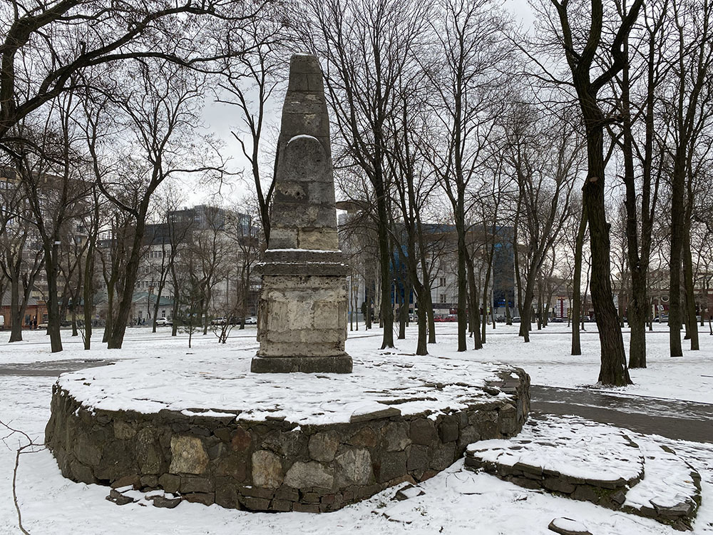
Catherine mile in Dnipro and Dnipropetrovsk region
In 1787 Catherine II traveled from the capital to the Ukraine and Crimea in order to inspect the lands annexed to the empire. At the initiative of the governor of the Taurian region Nechuy-Kakhovsky the so-called “miles” were established on the way of her travel.
Each verst of the road was marked with a verst post, and every 10 versts there were special posts – “miles”.
Nowadays such Catherine miles on the territory of Ukraine remained only in the Crimea, Dnepropetrovsk region and Kherson region. They are in the status of a National Monument of History. It is sad, because during the Soviet Union these monuments of history were destroyed on purpose – as a symbol of autocracy.
In Dnipropetrovsk region there are two of them – in the city of Dnipro and in the area of the village Volosskoe. In Dnipro Catherine mile stands on Sobornaya Square, and its historians consider it the first stone construction of Ekaterinoslav and in fact it may be from her went the modern city of Dnipro.
The second stands in the middle of the agricultural fields in Volossky.
Catherine mile is now a stone, laid out in the form of a hexagonal column with the top cone. At the base is a square stone pedestal.
For the especially lazy – you can try to find the monument in the city itself, and who is looking for adventure – go out into the field.
Mavrinsky Maidan in Pavlograd
If you find yourself near Pavlograd in the village Mezhirich and go to its outskirts, it may seem that you are in a field with many boulders.
On the ground it looks that way, but from a bird’s-eye view you can see a giant structure, nicknamed Mavrinsky Maidan. Somewhat reminiscent of a spider, a crab, or even a turtle.
Historians can not say exactly who erected it and why. They can only say that the Maidan of Maurin is more than five thousand years old. It has a shape of a circle with the rays departing from it, located strictly on three sides of the world.
Perhaps it was an ancient temple, or it was used as a temple, but an unknown civilization left it, or it was an observatory. The Cossacks used the mounds as defensive structures and it is not definitely their doing.
Mavrinsky Maidan has a strong energy, there are powerful sunsets and sunrises, trees do not grow here and birds do not fly, and on the day of the vernal equinox the sun sets strictly in the middle of the circle.
How to get to the Mavrin Maidan
From Pavlograd we take a shuttle bus to Mezhirich. Then from the village walk to the northeast. Or by car from Dbipro city or Pavlograd.
Mavrinsky Maidan coordinates on the map – 48.5596178, 35.8032954.